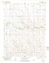
1978 Map of Codell
USGS Topo · Published 1979About this map
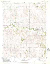
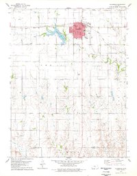
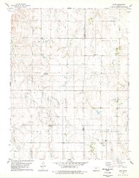
Codell sits at the heart of this landscape, positioned along the Union Pacific railroad line where it follows the valley of Paradise Creek. The settlement pattern reflects the late 20th-century agricultural and industrial character of the Rooks County and Ellis County border, with numerous Oil Wells and a defined Oil Field scattered across the township sections. The terrain transitions from the creek bottom to higher elevations like King Hill in the south, where the local economy appears rooted in both petroleum extraction and mineral resources, evidenced by a Gravel Pit. Genealogists will find the locations of Shiloh Cem and Center Cem useful for tracing family histories in the rural townships of Buckeye and Catherine.
Find a feature on this map
16 named features on this map. Tap any name to fly to it.
Don’t see what you’re looking for? This feature index may not catch every label — zoom into the map to look around manually.
Map Details
Editions of this 1978 Codell Map
This is the sole edition of this map. No revisions or reprints were ever made.
Other maps of this area

1896 · Plainville
USGS Topo · 1:125,000

1955 · Beloit
USGS Topo · 1:250,000

1959 · Beloit
USGS Topo · 1:250,000
1978 · Natoma
USGS Topo · 1:24,000
1978 · Plainville
USGS Topo · 1:24,000

1978 · Twin Mound
USGS Topo · 1:24,000

1978 · Turkville
USGS Topo · 1:24,000

1978 · Fairport
USGS Topo · 1:24,000

1978 · Plainville SE
USGS Topo · 1:24,000
1978 · Laton
USGS Topo · 1:24,000