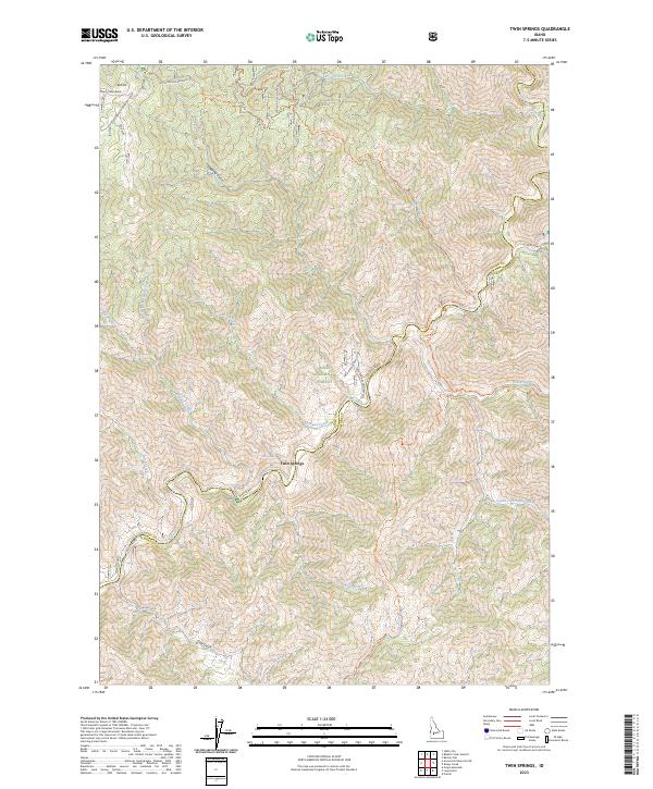
2023 Map of Twin Springs
USGS Topo · Published 2023About this map
The Twin Springs settlement serves as a central point in this remote section of the Boise National Forest, situated where the Boise River winds through the drainage basins of Elmore and Boise Counties. This 2023 survey documents the modern layout of the Atlanta Rd as it follows the river's path, providing access to backcountry landmarks like Thorn Creek Butte and Bald Mtn.
Find a feature on this map
36 named features on this map. Tap any name to fly to it.
Don’t see what you’re looking for? This feature index may not catch every label — zoom into the map to look around manually.
Map Details
Editions of this 2023 Twin Springs Map
This is the sole edition of this map. No revisions or reprints were ever made.
Other maps of this area

1894 · Idaho Basin
USGS Topo · 1:125,000

1955 · Hailey
USGS Topo · 1:250,000

1957 · Idaho City
USGS Topo · 1:24,000

1959 · Hailey
USGS Topo · 1:250,000

1962 · Hailey
USGS Topo · 1:250,000
1964 · Prairie
USGS Topo · 1:24,000

1964 · Sheep Creek
USGS Topo · 1:24,000

1964 · Twin Springs
USGS Topo · 1:24,000
1964 · Long Gulch
USGS Topo · 1:24,000
1969 · Arrowrock Reservoir NE
USGS Topo · 1:24,000