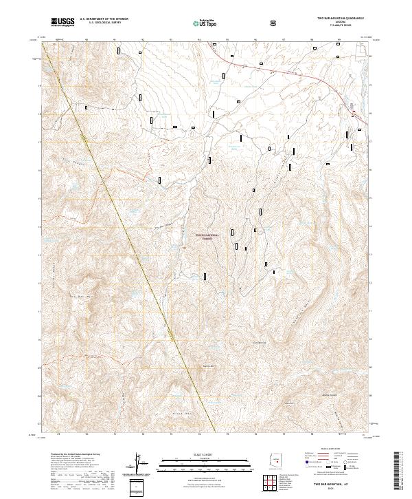
2021 Map of Two Bar Mountain
USGS Topo · Published 2021About this map
Tonto National Forest preserves a landscape of high ridges and desert canyons along the border of Gila and Maricopa Counties. The high point of Two Bar Mtn dominates the western topography, connected to Two Bar Ridge and looking out over a complex system of drainage and water sources including Cottonwood Spring, Tule Spring, and Monkey Spring. The historic Apache Trl snakes through the northeast corner, following the traditional route toward Pinto Cr. Human activity in this remote terrain is marked primarily by ranching infrastructure like Schoolhouse Tank and Henderson Tank, alongside a network of trails for traversal. Hikers today follow the Arizona National Scenic Trl as it winds across the canyons and past features like Tule Canyon and Two Bar Canyon.
Find a feature on this map
67 named features on this map. Tap any name to fly to it.
Don’t see what you’re looking for? This feature index may not catch every label — zoom into the map to look around manually.
Map Details
Editions of this 2021 Two Bar Mountain Map
This is the sole edition of this map. No revisions or reprints were ever made.
Other maps of this area

1900 · Florence
USGS Topo · 1:125,000

1901 · Globe
USGS Topo · 1:62,500

1902 · Globe
USGS Topo · 1:62,500

1902 · Florence
USGS Topo · 1:125,000

1907 · Roosevelt
USGS Topo · 1:125,000

1909 · Four Peaks
USGS Topo · 1:125,000

1912 · Roosevelt
USGS Topo · 1:125,000

1922 · Chrysotile
USGS Topo · 1:125,000

1945 · Inspiration
USGS Topo · 1:24,000

1947 · Inspiration
USGS Topo · 1:24,000