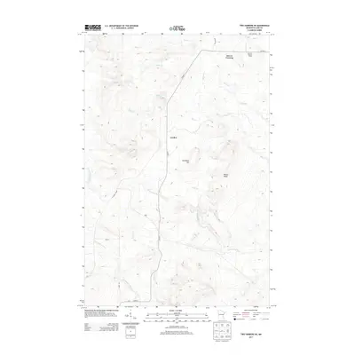
2013 Map of Two Harbors NE
USGS Topo · Published 2013About this map
London and Beaver Crossing sit within the high, stream-cut terrain of Lake County in this modern USGS survey. The landscape is defined by the headwaters and drainage networks of the Gooseberry River and the Encampment River, which flow through a topography marked by significant rises like Gustafson Hill and Bud Hill. A notable point of historical interest is the Bud Hill Lookout Tower, situated near the northern boundary, reflecting the region's managed wilderness and forestry heritage. The map also highlights the complex hydrography of the area, including Skunk Cr, Mink Cr, and Dago Cr, which carve through the land beneath Nester Bluffs. Local transport is anchored by Co HWY-3 and the E Alger Grade, providing a clear view of the rural infrastructure connecting these small North Shore-hinterland settlements.
Find a feature on this map
19 named features on this map. Tap any name to fly to it.
Don’t see what you’re looking for? This feature index may not catch every label — zoom into the map to look around manually.
Map Details
Editions of this 2013 Two Harbors NE Map
This is the sole edition of this map. No revisions or reprints were ever made.
Other maps of this area

1953 · Whyte
USGS Topo · 1:62,500

1954 · Silver Bay
USGS Topo · 1:62,500

1954 · Two Harbors
USGS Topo · 1:250,000

1956 · Split Rock Point
USGS Topo · 1:24,000

1956 · Split Rock Point
USGS Topo · 1:62,500

1957 · Two Harbors
USGS Topo · 1:250,000

1957 · Two Harbors
USGS Topo · 1:62,500

1957 · Two Harbors
USGS Topo · 1:24,000

1957 · Two Harbors NE
USGS Topo · 1:24,000

1957 · Castle Danger
USGS Topo · 1:24,000