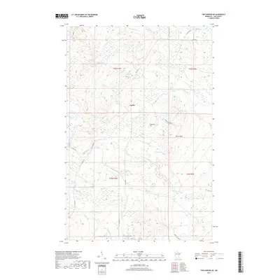
2019 Map of Two Harbors NE
USGS Topo · Published 2019About this map
The Gooseberry River and Encampment River carve deep drainages through this stretch of Lake County, Minnesota, as they head toward Lake Superior just south of the frame. The small settlement of London serves as a central point of reference, situated near the intersection of several logging and rural transport routes. The landscape is defined by its water systems and elevation changes, featuring expansive areas like Murphy Swamp and prominent topographic markers including Gustafson Hill and Nester Bluffs. Historical logging and transit patterns are etched into the terrain via old grades such as N Alger Grade and E Alger Grade, reflecting the region's industrial heritage. Numerous small tributaries, including Mink Cr, Skunk Cr, and Dago Cr, weave through the heavily wooded townships of T55N R10W and T54N R9W, creating a complex network of wetlands and ravines.
Find a feature on this map
26 named features on this map. Tap any name to fly to it.
Don’t see what you’re looking for? This feature index may not catch every label — zoom into the map to look around manually.
Map Details
Editions of this 2019 Two Harbors NE Map
This is the sole edition of this map. No revisions or reprints were ever made.
Other maps of this area

1953 · Whyte
USGS Topo · 1:62,500

1954 · Silver Bay
USGS Topo · 1:62,500

1954 · Two Harbors
USGS Topo · 1:250,000

1956 · Split Rock Point
USGS Topo · 1:24,000

1956 · Split Rock Point
USGS Topo · 1:62,500

1957 · Two Harbors
USGS Topo · 1:250,000

1957 · Two Harbors
USGS Topo · 1:62,500

1957 · Two Harbors
USGS Topo · 1:24,000

1957 · Two Harbors NE
USGS Topo · 1:24,000

1957 · Castle Danger
USGS Topo · 1:24,000