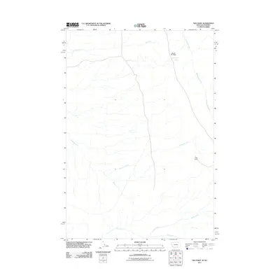
2011 Map of Two Point
USGS Topo · Published 2011About this map
Big Bull Elk Ridge dominates the northern landscape of this Big Horn County region, serving as a prominent landform above the drainages of Gyp Creek and Big Bull Elk Creek. The area is characterized by its network of water sources, including the isolated Crystal Cave Spring located just below the ridge. The settlement of Two Point sits central to the southern half of the quadrangle, positioned near the meandering course of Twentymile Creek. The map documents a predominantly rural and open terrain as it existed in 2011, where the land is defined by long-established creek systems such as Willow Creek and Trout Creek that shape the local geography. This survey provides a clear view of the sparse settlement patterns and the natural hydrography that dictates the movement and life of this Montana-Wyoming borderland.
Find a feature on this map
8 named features on this map. Tap any name to fly to it.
Don’t see what you’re looking for? This feature index may not catch every label — zoom into the map to look around manually.
Map Details
Editions of this 2011 Two Point Map
This is the sole edition of this map. No revisions or reprints were ever made.
Other maps of this area

1894 · St. Xavier
USGS Topo · 1:125,000

1898 · Bald Mountain
USGS Topo · 1:125,000

1901 · St. Xavier
USGS Topo · 1:125,000

1901 · Bald Mountain
USGS Topo · 1:125,000

1954 · Billings
USGS Topo · 1:250,000

1954 · Hardin
USGS Topo · 1:250,000

1955 · Cody
USGS Topo · 1:250,000

1955 · Sheridan
USGS Topo · 1:250,000

1957 · Hardin
USGS Topo · 1:250,000

1957 · Billings
USGS Topo · 1:250,000