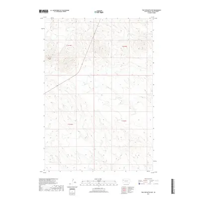
2017 Map of Two Top Butte East
USGS Topo · Published 2017About this map
Two Top Butte dominates the northwestern corner of this landscape in Butte County, providing a significant vertical landmark above the surrounding drainage basins. The terrain is defined by the ephemeral flow of several waterways, including Willow Cr and Horse Cr, which wind through the township boundaries of T12N R4E and T11N R5E. The drainage network is further mapped into the southeast through Dry Cr. This area of the South Dakota plains maintains a sparse, open character with limited development, focusing on the natural topography and the legal subdivisions of the Public Land Survey System. The map illustrates how these small creeks dictate the local relief, creating a series of draws and ridges that characterize this portion of the northern Great Plains.
Find a feature on this map
8 named features on this map. Tap any name to fly to it.
Don’t see what you’re looking for? This feature index may not catch every label — zoom into the map to look around manually.
Map Details
Editions of this 2017 Two Top Butte East Map
This is the sole edition of this map. No revisions or reprints were ever made.
Other maps of this area

1906 · Two Top
USGS Topo · 1:62,500

1907 · Belle Fourche
USGS Topo · 1:125,000

1913 · Newell
USGS Topo · 1:125,000

1935 · Hoover
USGS Topo · 1:125,000

1935 · Harding
USGS Topo · 1:125,000

1953 · Rapid City
USGS Topo · 1:250,000

1954 · Lemmon
USGS Topo · 1:250,000

1957 · Lemmon
USGS Topo · 1:250,000

1957 · Rapid City
USGS Topo · 1:250,000
1965 · Two Top Butte West
USGS Topo · 1:24,000