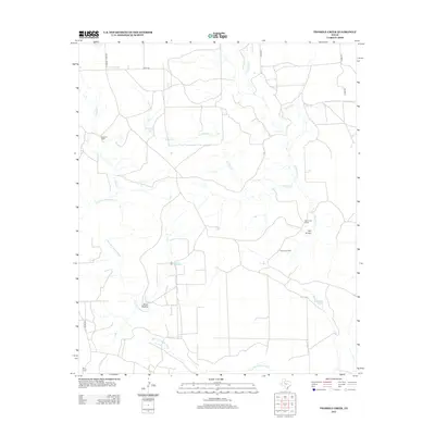
2012 Map of Twomile Creek
USGS Topo · Published 2012About this map
The Salt Fork Brazos River flows across this corner of Garza County, carving a path through a landscape defined by ranching life and seasonal water management. Established outposts such as Swenson Ranch and Bird Ranch anchor the territory, while the presence of Red Arroyo Camp reflects the continued agricultural and pastoral utility of this West Texas terrain. The map details a complex system of drainage and storage necessary for the arid climate, including Twomile Tank, Horse Hollow Tank, and Red Arroyo Tank, which serve the local cattle industry. Natural landmarks like Horse Hollow and Red Arroyo intersect with the namesake Twomile Cr and White River, providing a clear record of the area's hydrology and land-use patterns in the early 21st century.
Find a feature on this map
19 named features on this map. Tap any name to fly to it.
Don’t see what you’re looking for? This feature index may not catch every label — zoom into the map to look around manually.
Map Details
Editions of this 2012 Twomile Creek Map
This is the sole edition of this map. No revisions or reprints were ever made.
Other maps of this area

1954 · Lubbock
USGS Topo · 1:250,000

1962 · Twomile Creek
USGS Topo · 1:24,000

1962 · Smith Tank
USGS Topo · 1:24,000

1966 · Kalgary
USGS Topo · 1:24,000

1967 · Spur NW
USGS Topo · 1:24,000

1968 · Spur SW
USGS Topo · 1:24,000

1969 · Verbena
USGS Topo · 1:24,000

1969 · Cottonwood Creek
USGS Topo · 1:24,000
1969 · Justiceburg NW
USGS Topo · 1:24,000

1969 · T-O Creek
USGS Topo · 1:24,000