
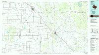
1966 Map of Kalgary
USGS Topo · Published 1968About this map
The small settlement of Kalgary sits at a crossroads in the mid-1960s, marking the transition between the rolling high plains and the breaking canyons of the Texas Caprock. This survey captures a rural landscape defined by intricate drainage systems, where numerous waterways like McDonald Creek, Yankee Creek, and Davidson Creek carve through the terrain. The presence of a long Aqueduct cutting across the eastern and southern portions of the quadrangle highlights the critical infrastructure required for water management in this part of West Texas. Spanning the boundary of Crosby Co and Garza Co, the map reveals a sparsely populated ranching and agricultural environment. Scattered landmarks such as a Drill Hole and the elevation marker Bm 2504 provide specific points of interest for those studying the physical history of the region.
Find a feature on this map
11 named features on this map. Tap any name to fly to it.
Don’t see what you’re looking for? This feature index may not catch every label — zoom into the map to look around manually.
Map Details
Editions of this 1966 Kalgary Map
This is the sole edition of this map. No revisions or reprints were ever made.
Other maps of this area

1954 · Lubbock
USGS Topo · 1:250,000

1961 · Bunker Hill
USGS Topo · 1:24,000

1962 · Twomile Creek
USGS Topo · 1:24,000

1962 · Smith Tank
USGS Topo · 1:24,000

1966 · Collett Springs
USGS Topo · 1:24,000

1966 · Canyon Valley
USGS Topo · 1:24,000

1967 · Ralls SE
USGS Topo · 1:24,000

1969 · Verbena
USGS Topo · 1:24,000

1969 · Cap Rock SE
USGS Topo · 1:24,000
1986 · Slaton
USGS Topo · 1:100,000