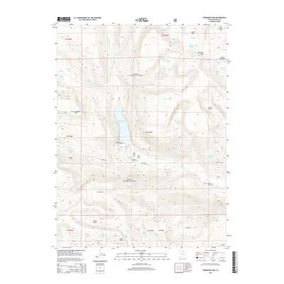
2014 Map of Tworoose Pass
USGS Topo · Published 2014About this map
Ashley National Forest dominates this high-elevation landscape, where the waters of Rock Creek and its various forks have been heavily engineered for water management. The massive Upper Stillwater Reservoir and the nearby Stillwater Tunnel reflect the complex infrastructure designed to store and divert water in this part of Duchesne County. This area serves as a significant recreational and agricultural hub, evidenced by the presence of Rock Creek Ranch, the Rock Creek Resort, and several developed sites like Upper Stillwater Campground and Yellow Pine Campground.
Find a feature on this map
47 named features on this map. Tap any name to fly to it.
Don’t see what you’re looking for? This feature index may not catch every label — zoom into the map to look around manually.
Map Details
Editions of this 2014 Tworoose Pass Map
This is the sole edition of this map. No revisions or reprints were ever made.
Other maps of this area

1885 · Uinta
USGS Topo · 1:250,000

1901 · Hayden Peak
USGS Topo · 1:125,000

1903 · Hayden Peak
USGS Topo · 1:125,000

1954 · Salt Lake City
USGS Topo · 1:250,000

1958 · Salt Lake City
USGS Topo · 1:250,000

1960 · Salt Lake City
USGS Topo · 1:250,000

1962 · Hanna
USGS Topo · 1:24,000

1962 · Dry Mountain
USGS Topo · 1:24,000
1962 · Farm Creek Peak
USGS Topo · 1:24,000
1967 · Kidney Lake
USGS Topo · 1:24,000