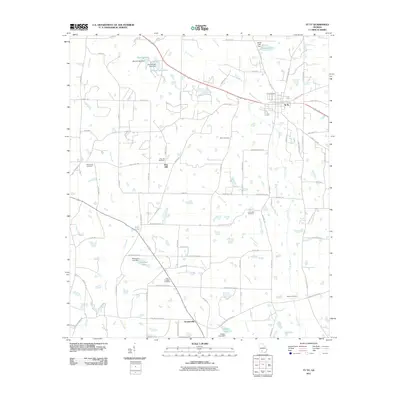
2011 Map of Ty Ty
USGS Topo · Published 2011About this map
Ty Ty and the surrounding Georgia countryside are mapped here during a period of steady rural development. The landscape is defined by a network of agricultural drainage and family-named landmarks, with Ty Ty Creek and Lolly Creek winding through the terrain. Numerous small impoundments such as Harold Lake and Patterson Lake illustrate the local importance of water management for the surrounding farms. The settlement of Scooterville sits in the southern portion of the sheet, connected by a grid of county roads like EW Booth Rd and Earlene Sizemore Rd. Genealogists will find significant value in the distribution of burial sites, including Ty Ty Cemetery, New Prospect Cemetery, and Willis Cemetery, which anchor the various community centers. This survey provides a clear view of the area's transition into the twenty-first century, preserving the placement of rural homesteads and legacy schools like Pine Hill.
Find a feature on this map
79 named features on this map. Tap any name to fly to it.
Don’t see what you’re looking for? This feature index may not catch every label — zoom into the map to look around manually.
Map Details
Editions of this 2011 Ty Ty Map
This is the sole edition of this map. No revisions or reprints were ever made.
Other maps of this area

1953 · Waycross
USGS Topo · 1:250,000

1956 · Sylvester
USGS Topo · 1:62,500

1956 · Doerun
USGS Topo · 1:62,500

1958 · Waycross
USGS Topo · 1:250,000

1973 · Sumner
USGS Topo · 1:24,000

1973 · Ty Ty
USGS Topo · 1:24,000

1973 · Norman Park
USGS Topo · 1:24,000

1973 · Sylvester
USGS Topo · 1:24,000

1973 · Chula
USGS Topo · 1:24,000

1973 · Tifton West
USGS Topo · 1:24,000