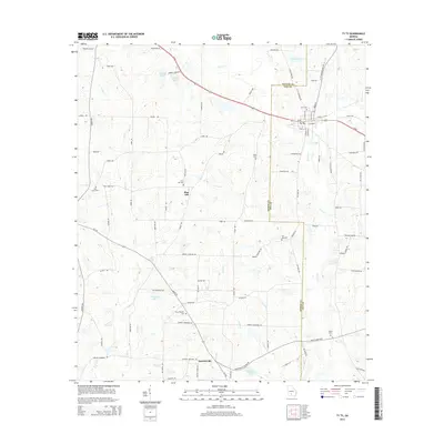
2014 Map of Ty Ty
USGS Topo · Published 2014About this map
Ty Ty serves as a focal point along the Us-82 corridor, situated on the border of the Worth Co Tift Co line. This 2014 survey reveals a landscape defined by agricultural road networks and a series of small, significant family and community landmarks. The settlement of Scooterville lies to the south, connected by Ga-256, while Pine Hill occupies a central position among the local drainage systems. Water features like Lolly Cr and Ty Ty Cr carve through the terrain, supporting several local impoundments such as Patterson Lake and Lake Lolly. The map is particularly useful for genealogical research, documenting numerous rural burial grounds including Salem Cem, New Prospect Cem, and the Ty Ty Cem. The grid of secondary roads like Gibbs Rd and Hansel Rd illustrates the persistent rural infrastructure of this South Georgia region.
Find a feature on this map
87 named features on this map. Tap any name to fly to it.
Don’t see what you’re looking for? This feature index may not catch every label — zoom into the map to look around manually.
Map Details
Editions of this 2014 Ty Ty Map
This is the sole edition of this map. No revisions or reprints were ever made.
Other maps of this area

1953 · Waycross
USGS Topo · 1:250,000

1956 · Sylvester
USGS Topo · 1:62,500

1956 · Doerun
USGS Topo · 1:62,500

1958 · Waycross
USGS Topo · 1:250,000

1973 · Sumner
USGS Topo · 1:24,000

1973 · Ty Ty
USGS Topo · 1:24,000

1973 · Norman Park
USGS Topo · 1:24,000

1973 · Sylvester
USGS Topo · 1:24,000

1973 · Chula
USGS Topo · 1:24,000

1973 · Tifton West
USGS Topo · 1:24,000