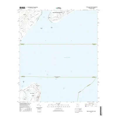
2017 Map of Tybee Island North
USGS Topo · Published 2017About this map
Hilton Head Island and Tybee Island dominate this coastal survey, where the maritime borders of South Carolina and Georgia meet in the Atlantic Ocean. The map documents the northern tip of Tybee Island at Fort Screven, a site of significant military history situated along the Tybee Roads. Navigational markers such as the Tybee Knoll Cut Range and Jones Island Range illustrate the complex shipping channels required to enter the Cock Spur Island Channel.
Find a feature on this map
69 named features on this map. Tap any name to fly to it.
Don’t see what you’re looking for? This feature index may not catch every label — zoom into the map to look around manually.
Map Details
Editions of this 2017 Tybee Island North Map
This is the sole edition of this map. No revisions or reprints were ever made.
Other maps of this area

1920 · Wassaw Sound
USGS Topo · 1:62,500

1920 · Hilton Head
USGS Topo · 1:62,500

1920 · Bluffton
USGS Topo · 1:62,500

1945 · Bluffton
USGS Topo · 1:62,500

1945 · Hilton Head
USGS Topo · 1:62,500

1945 · Wassaw Sound
USGS Topo · 1:62,500

1946 · Brunswick
USGS Topo · 1:250,000

1947 · Savannah
USGS Topo · 1:250,000

1948 · Brunswick
USGS Topo · 1:250,000

1948 · Savannah
USGS Topo · 1:250,000