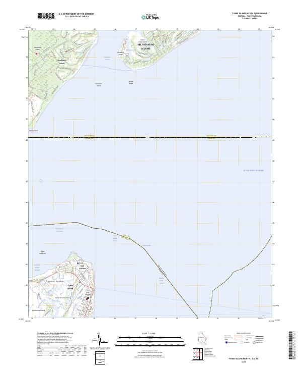
2024 Map of Tybee Island North
USGS Topo · Published 2024About this map
Fort Screven stands at the northern tip of Tybee Island, overlooking the strategic waters where Tybee Roads meets the Atlantic Ocean. This maritime landscape is defined by the complex interface of South Carolina and Georgia, where Daufuskie Island and Hilton Head Island are separated by the deep waters of Calibogue Sound. The residential patterns on the islands are visible through modern street layouts like Ave of Oaks and Bloody Point Dr, while the interior marshlands are punctuated by features like Horse Pen Hammock and Spanish Hammock. Genealogists and local historians can locate the Tybee Memorial Cem near the southern boundary of the developed town. The map detail highlights the intricate network of tidal creeks including Chimney Creek and Horse Pen Creek, which have long dictated the movement and settlement of the Sea Islands.
Find a feature on this map
72 named features on this map. Tap any name to fly to it.
Don’t see what you’re looking for? This feature index may not catch every label — zoom into the map to look around manually.
Map Details
Editions of this 2024 Tybee Island North Map
This is the sole edition of this map. No revisions or reprints were ever made.
Other maps of this area

1920 · Wassaw Sound
USGS Topo · 1:62,500

1920 · Hilton Head
USGS Topo · 1:62,500

1920 · Bluffton
USGS Topo · 1:62,500

1945 · Bluffton
USGS Topo · 1:62,500

1945 · Hilton Head
USGS Topo · 1:62,500

1945 · Wassaw Sound
USGS Topo · 1:62,500

1946 · Brunswick
USGS Topo · 1:250,000

1947 · Savannah
USGS Topo · 1:250,000

1948 · Brunswick
USGS Topo · 1:250,000

1948 · Savannah
USGS Topo · 1:250,000