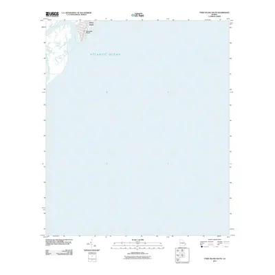
2011 Map of Tybee Island South
USGS Topo · Published 2011About this map
Tybee Island and its coastal community at Savannah Beach occupy the upper left corner of this survey, which is dominated by the expansive Atlantic Ocean. The map documents the barrier island's southern reaches, where the street grid of the beach town gives way to the tidal marshes and waterways of Tybee Creek. Because this sheet primarily covers the offshore waters and the immediate shoreline, it provides a precise record of the coastal interface and inlet positioning as they existed in the early 21st century. It serves as a specific reference for the layout of the southern tip of the island before any further contemporary shoreline shifts or residential developments occurred.
Find a feature on this map
4 named features on this map. Tap any name to fly to it.
Don’t see what you’re looking for? This feature index may not catch every label — zoom into the map to look around manually.
Map Details
Editions of this 2011 Tybee Island South Map
This is the sole edition of this map. No revisions or reprints were ever made.
Other maps of this area

1920 · Wassaw Sound
USGS Topo · 1:62,500

1920 · Hilton Head
USGS Topo · 1:62,500

1920 · Bluffton
USGS Topo · 1:62,500

1945 · Bluffton
USGS Topo · 1:62,500

1945 · Hilton Head
USGS Topo · 1:62,500

1945 · Wassaw Sound
USGS Topo · 1:62,500

1946 · Brunswick
USGS Topo · 1:250,000

1947 · Savannah
USGS Topo · 1:250,000

1948 · Brunswick
USGS Topo · 1:250,000

1948 · Savannah
USGS Topo · 1:250,000