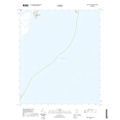
2020 Map of Tybee Island South
USGS Topo · Published 2020About this map
Tybee Island occupies the northwestern corner of this coastal study, marking the transition between the Georgia marshlands and the open Atlantic Ocean. The settlement pattern at the southern end of the island is clearly defined by a dense grid of streets, including Strand Ave and Chatham Ave, which terminate near the water's edge. This 2020 map documents the reach of US Hwy 80 as it enters the coastal zone, providing a precise record of the developed shoreline within the Sea Islands chain. The eastern portion of the sheet is dominated by the ocean, while the western side follows the winding course of Tybee Creek through the tidal environment. This survey is a valuable resource for understanding the modern footprint of coastal development and maritime boundaries along the Georgia coast.
Find a feature on this map
16 named features on this map. Tap any name to fly to it.
Don’t see what you’re looking for? This feature index may not catch every label — zoom into the map to look around manually.
Map Details
Editions of this 2020 Tybee Island South Map
This is the sole edition of this map. No revisions or reprints were ever made.
Other maps of this area

1920 · Wassaw Sound
USGS Topo · 1:62,500

1920 · Hilton Head
USGS Topo · 1:62,500

1920 · Bluffton
USGS Topo · 1:62,500

1945 · Bluffton
USGS Topo · 1:62,500

1945 · Hilton Head
USGS Topo · 1:62,500

1945 · Wassaw Sound
USGS Topo · 1:62,500

1946 · Brunswick
USGS Topo · 1:250,000

1947 · Savannah
USGS Topo · 1:250,000

1948 · Brunswick
USGS Topo · 1:250,000

1948 · Savannah
USGS Topo · 1:250,000