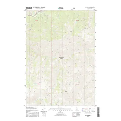
2017 Map of Tyee Mountain
USGS Topo · Published 2017About this map
Tyee Mtn dominates the southern landscape of this 2017 survey, a prominent anchor within the Boise National Forest. The topography is defined by the massive drainage systems of the S Fork Payette River in the northwest and the Bear River to the south. Historically significant travel corridors, including Old Hwy 21 and the Frank Creek Road, trace the lower elevations near the riverbanks, while Pikes Fork follows the winding path of the Crooked River. High-elevation features like Ten Mile Ridge separate the northern watersheds of Mac Donald Creek and Tenmile Cr. This map illustrates the intricate network of mountain tributaries, such as Little Silver Cr and Horseshoe Cr, that feed the larger river basins in this portion of Idaho-Boise County.
Find a feature on this map
28 named features on this map. Tap any name to fly to it.
Don’t see what you’re looking for? This feature index may not catch every label — zoom into the map to look around manually.
Map Details
Editions of this 2017 Tyee Mountain Map
This is the sole edition of this map. No revisions or reprints were ever made.
Other maps of this area

1891 · Bear Valley
USGS Topo · 1:125,000

1893 · Bear Valley
USGS Topo · 1:125,000

1894 · Rocky Bar
USGS Topo · 1:125,000

1955 · Hailey
USGS Topo · 1:250,000

1957 · Challis
USGS Topo · 1:250,000

1959 · Hailey
USGS Topo · 1:250,000

1960 · Challis
USGS Topo · 1:250,000

1962 · Hailey
USGS Topo · 1:250,000

1963 · Challis
USGS Topo · 1:250,000
1972 · Bear River
USGS Topo · 1:24,000