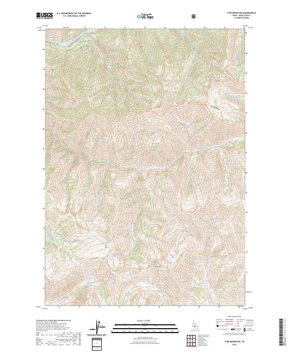
2024 Map of Tyee Mountain
USGS Topo · Published 2024About this map
Boise National Forest and the rugged eastern boundary of the Sawtooth Wilderness dominate this high-altitude landscape. The South Fork Payette River cuts through the northwest corner, paralleled by Old Hwy 21 and the modern Idaho City-Stanley-SH21 route. The terrain is defined by dramatic elevation changes, notably along the expansive Ten Mile Ridge and at the summit of Tyee Mtn.
Find a feature on this map
27 named features on this map. Tap any name to fly to it.
Don’t see what you’re looking for? This feature index may not catch every label — zoom into the map to look around manually.
Map Details
Editions of this 2024 Tyee Mountain Map
This is the sole edition of this map. No revisions or reprints were ever made.
Other maps of this area

1891 · Bear Valley
USGS Topo · 1:125,000

1893 · Bear Valley
USGS Topo · 1:125,000

1894 · Rocky Bar
USGS Topo · 1:125,000

1955 · Hailey
USGS Topo · 1:250,000

1957 · Challis
USGS Topo · 1:250,000

1959 · Hailey
USGS Topo · 1:250,000

1960 · Challis
USGS Topo · 1:250,000

1962 · Hailey
USGS Topo · 1:250,000

1963 · Challis
USGS Topo · 1:250,000
1972 · Bear River
USGS Topo · 1:24,000