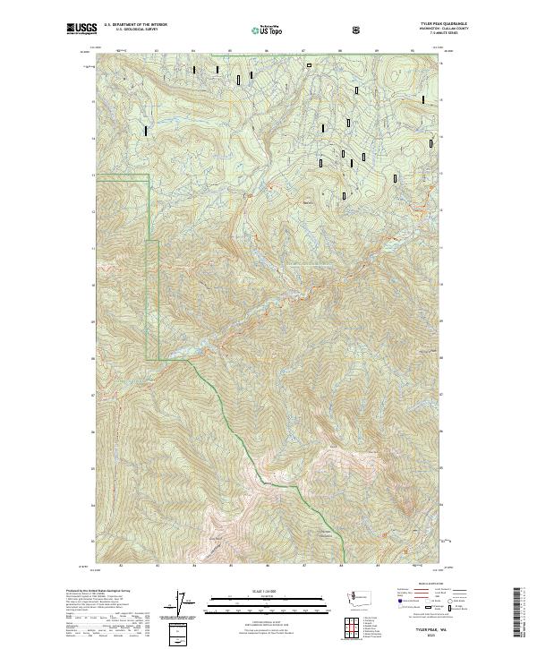
2023 Map of Tyler Peak
USGS Topo · Published 2023About this map
The Olympic Mountains dominate this high-elevation terrain, where the Gray Wolf River and Dungeness River carve through steep alpine landscapes. This 2023 survey delineates the complex administrative boundaries of the Olympic National Park, Olympic National Forest, and the Buckhorn Wilderness. A network of backcountry routes, such as the Deer Ridge Trl and Slab Camp Trl, provides the primary access to prominent summits like Tyler Peak, Maynard Peak, and the high point at Baldy. The map reveals the intricate drainage patterns of the northeast Olympics, tracing the descent of McDonald Creek and Rock Creek from the high Gray Wolf Ridge toward the lowlands. This modern topographic record captures a landscape primarily dedicated to conservation and wilderness recreation, where natural watercourses and ridge lines remain the most significant landmarks.
Find a feature on this map
47 named features on this map. Tap any name to fly to it.
Don’t see what you’re looking for? This feature index may not catch every label — zoom into the map to look around manually.
Map Details
Editions of this 2023 Tyler Peak Map
This is the sole edition of this map. No revisions or reprints were ever made.
Other maps of this area

1918 · Port Angeles
USGS Topo · 1:62,500

1938 · Mt Constance
USGS Topo · 1:125,000

1938 · Dungeness
USGS Topo · 1:62,500

1939 · Dungeness
USGS Topo · 1:62,500

1941 · Port Angeles
USGS Topo · 1:62,500

1944 · Mt. Angeles
USGS Topo · 1:62,500

1946 · Mt. Angeles
USGS Topo · 1:62,500

1946 · Tyler Peak
USGS Topo · 1:62,500

1948 · Tyler Peak
USGS Topo · 1:62,500

1956 · Sequim
USGS Topo · 1:24,000