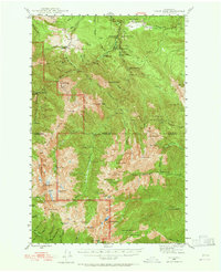
1946 Map of Tyler Peak
USGS Topo · Published 1965About this map
Tyler Peak and its surrounding high-country watersheds dominate this 1946 survey, which documents the primitive backcountry infrastructure of the Olympic National Park and Olympic National Forest. The map captures a network of interior shelters and camps established for rangers and early mountain travelers, including Royal Creek Cabin, Louella Guard Sta, and the curiously named Camp Mystery. The landscape is defined by the steep drainages of the Dungeness River and Gray Wolf River, with the Tubal Cain Mine serving as a rare industrial point of interest amidst the peaks. High-altitude landmarks such as Mt Deception and Mt Constance anchor the southern boundary, while numerous trail-side sites like Tenmile Shelter and Camp Tony illustrate the era's reliance on a robust system of pack-animal and foot-travel routes through the Clallam and Jefferson county line.
Find a feature on this map
94 named features on this map. Tap any name to fly to it.
Don’t see what you’re looking for? This feature index may not catch every label — zoom into the map to look around manually.
Map Details
Editions of this 1946 Tyler Peak Map

Other maps of this area

1918 · Port Angeles
USGS Topo · 1:62,500

1936 · Point Misery
USGS Topo · 1:62,500

1938 · Mt Constance
USGS Topo · 1:125,000

1938 · Dungeness
USGS Topo · 1:62,500

1939 · Port Townsend
USGS Topo · 1:62,500

1939 · Dungeness
USGS Topo · 1:62,500

1940 · Point Misery
USGS Topo · 1:62,500

1940 · Quilcene
USGS Topo · 1:62,500

1941 · Port Angeles
USGS Topo · 1:62,500

1944 · Mt. Angeles
USGS Topo · 1:62,500