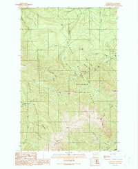
1990 Map of Tyler Peak
USGS Topo · Published 1990About this map
Olympic National Park and the adjacent Buckhorn Wilderness converge on this topographic study, capturing a high-elevation landscape defined by deep drainages and sharp peaks. The Gray Wolf River and Dungeness River anchor the drainage systems, punctuated by a series of primitive backcountry outposts including Three Forks Shelter, Gray Wolf Camp, and Slide Camp. These sites, along with others like Camp Ellis and Cliff Camp, suggest a network of historical routes through the Olympic National Forest. Significant physical landmarks such as Tyler Peak, Maynard Peak, and Ned Hill dominate the skyline. The presence of several quarries near Caraco Creek and Pats Creek provides a glimpse into the localized resource extraction within these protected zones, while the numerous Pack Trails and footbridges reveal the era's infrastructure for navigating this complex terrain.
Find a feature on this map
36 named features on this map. Tap any name to fly to it.
Don’t see what you’re looking for? This feature index may not catch every label — zoom into the map to look around manually.
Map Details
Editions of this 1990 Tyler Peak Map
This is the sole edition of this map. No revisions or reprints were ever made.
Other maps of this area

1918 · Port Angeles
USGS Topo · 1:62,500

1938 · Mt Constance
USGS Topo · 1:125,000

1938 · Dungeness
USGS Topo · 1:62,500

1939 · Dungeness
USGS Topo · 1:62,500

1941 · Port Angeles
USGS Topo · 1:62,500

1944 · Mt. Angeles
USGS Topo · 1:62,500

1946 · Mt. Angeles
USGS Topo · 1:62,500

1946 · Tyler Peak
USGS Topo · 1:62,500

1948 · Tyler Peak
USGS Topo · 1:62,500

1956 · Sequim
USGS Topo · 1:24,000