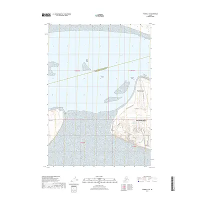
2019 Map of Tyonek A-1 NE
USGS Topo · Published 2019About this map
Anchorage meets the waters of the Knik Arm on this modern survey of Alaska's coastal infrastructure and recreational landscapes. The prominent expanse of the Ted Stevens Anchorage International Airport dominates the shoreline, adjacent to the extensive network of paths including the Tony Knowles Coastal Trail and the Kincaid Bluff Trail. Further offshore, Fire Island and its associated Fire Island Airport sit across the channel from Point Campbell, separated by hazardous shoals such as North Point Shoal and Knik Arm Shoal. The inland areas are marked by a high density of named trails and landmarks like Little Campbell Lake and Middle Earth, reflecting the area's development as a major transportation and recreational hub where the Matanuska-Susitna Borough Anchorage Municipality boundary crosses the water.
Find a feature on this map
43 named features on this map. Tap any name to fly to it.
Don’t see what you’re looking for? This feature index may not catch every label — zoom into the map to look around manually.
Map Details
Editions of this 2019 Tyonek A-1 NE Map
This is the sole edition of this map. No revisions or reprints were ever made.
Other maps of this area

1949 · Tyonek
USGS Topo · 1:250,000

1951 · Anchorage
USGS Topo · 1:250,000

1951 · Tyonek
USGS Topo · 1:250,000

1951 · Tyonek A-1
USGS Topo · 1:63,360

1952 · Tyonek A-1
USGS Topo · 1:63,360

1952 · Anchorage A-8
USGS Topo · 1:63,360

1952 · Anchorage B-8
USGS Topo · 1:63,360

1953 · Anchorage A-8
USGS Topo · 1:63,360

1953 · Anchorage B-8
USGS Topo · 1:63,360

1958 · Tyonek B-1
USGS Topo · 1:63,360