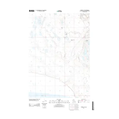
2013 Map of Tyonek B-1 SE
USGS Topo · Published 2013About this map
Turinsky Airstrip and several other private flight facilities characterize this portion of the Matanuska-Susitna Borough, highlighting the region's reliance on small-craft aviation for transport and access. Located just inland from the Knik Arm Pacific Ocean, the landscape is a dense network of small water bodies and marshland, including Horseshoe Lake, Barley Lake, and Twin Island Lake. The infrastructure is sparse, defined by essential connectors like Point Mackenzie Rd and Guernsey Rd that navigate between the wetlands. The presence of the Lost Lake Seaplane base and the Flyway Farm Airstrip suggests a pattern of remote settlement where traditional road networks are secondary to the specialized runways and water-based landing zones required for Alaskan bush travel.
Find a feature on this map
18 named features on this map. Tap any name to fly to it.
Don’t see what you’re looking for? This feature index may not catch every label — zoom into the map to look around manually.
Map Details
Editions of this 2013 Tyonek B-1 SE Map
This is the sole edition of this map. No revisions or reprints were ever made.
Other maps of this area

1949 · Tyonek
USGS Topo · 1:250,000

1951 · Anchorage
USGS Topo · 1:250,000

1951 · Tyonek
USGS Topo · 1:250,000

1951 · Tyonek A-1
USGS Topo · 1:63,360

1952 · Tyonek A-1
USGS Topo · 1:63,360

1952 · Anchorage A-8
USGS Topo · 1:63,360

1952 · Anchorage B-8
USGS Topo · 1:63,360

1953 · Anchorage A-8
USGS Topo · 1:63,360

1953 · Anchorage B-8
USGS Topo · 1:63,360

1958 · Tyonek B-1
USGS Topo · 1:63,360