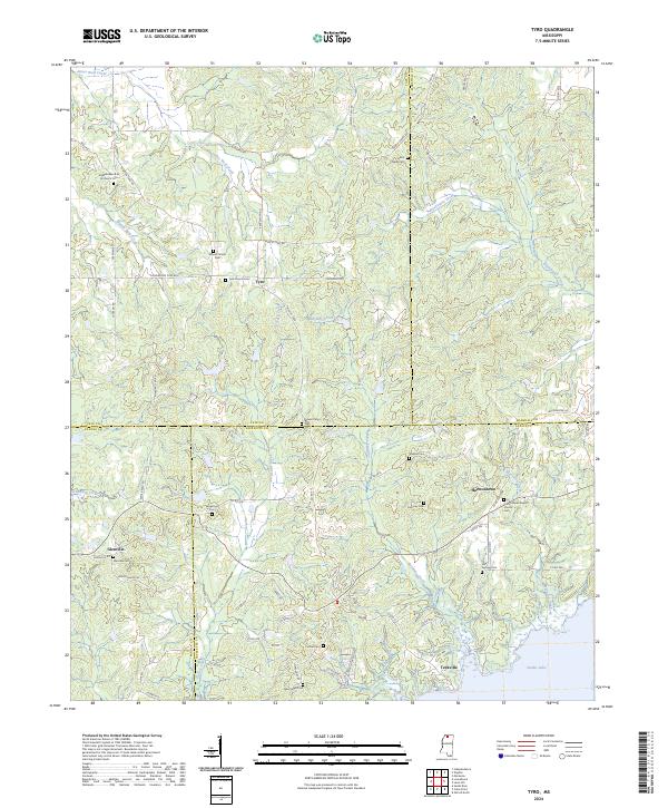
2024 Map of Tyro
USGS Topo · Published 2024About this map
Sardis Lake dominates the southeastern corner of this landscape, where the northern reaches of the reservoir meet the varied terrain of the Mississippi hill country. The map documents a rural network of small communities including Tyro, Harmontown, and Glenville, each anchored by historical anchors like the Tyro Church and the Harmontown Baptist Church. The area is notably dense with family and community burial grounds, such as Mount Patient Cem, Mount Peryn Cem, and Independence M B Church Cem, providing a detailed record for genealogical research in this multi-county border region where Tate, Marshall, Panola, and Lafayette counties converge. Waterways like Lafomby Creek and James Wolf Canal define the drainage patterns that shaped local settlement, while a web of secondary roads like Thyatra Tyro Rd and Looxahoma Tyro Rd connect the scattered homesteads and farming tracts of the early 21st century.
Find a feature on this map
78 named features on this map. Tap any name to fly to it.
Don’t see what you’re looking for? This feature index may not catch every label — zoom into the map to look around manually.
Map Details
Editions of this 2024 Tyro Map
This is the sole edition of this map. No revisions or reprints were ever made.
Other maps of this area

1940 · Oxford
USGS Topo · 1:62,500

1943 · Oxford
USGS Topo · 1:62,500

1944 · Senatobia
USGS Topo · 1:62,500

1944 · Tyro
USGS Topo · 1:62,500

1952 · Sardis
USGS Topo · 1:62,500

1953 · Sardis
USGS Topo · 1:62,500

1956 · Tupelo
USGS Topo · 1:250,000

1958 · Tupelo
USGS Topo · 1:250,000
1971 · Marianna
USGS Topo · 1:24,000

1971 · Wyatte
USGS Topo · 1:24,000