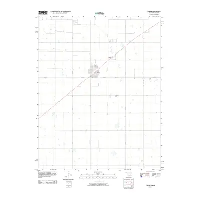
2010 Map of Tyrone
USGS Topo · Published 2010About this map
Tyrone serves as the central hub for this portion of the Oklahoma Panhandle, situated near the Kansas border. The town is defined by its precise street grid and proximity to the smaller community of Fluor to the northeast. The surrounding landscape in Texas County is characterized by a sprawling system of section-line roads, including Co Hwy 53 and Co Hwy D, which facilitate movement across the agricultural expanse. Small, scattered depressions across the terrain indicate the localized hydrology of the High Plains. To the southeast of the main settlement lies Tyrone Cemetery, a significant point for genealogical research. The layout reflects a deeply ordered rural infrastructure, where named routes like Palmer and various lettered roads provide a framework for the region's ranching and farming heritage.
Find a feature on this map
21 named features on this map. Tap any name to fly to it.
Don’t see what you’re looking for? This feature index may not catch every label — zoom into the map to look around manually.
Map Details
Editions of this 2010 Tyrone Map
This is the sole edition of this map. No revisions or reprints were ever made.
Other maps of this area

1954 · Perryton
USGS Topo · 1:250,000

1955 · Dodge City
USGS Topo · 1:250,000

1958 · Perryton
USGS Topo · 1:250,000

1958 · Dodge City
USGS Topo · 1:250,000

1959 · Dodge City
USGS Topo · 1:250,000

1967 · Hooker
USGS Topo · 1:24,000

1967 · Adams
USGS Topo · 1:24,000

1967 · Hooker NW
USGS Topo · 1:24,000

1967 · Tyrone
USGS Topo · 1:24,000

1971 · Liberal
USGS Topo · 1:24,000