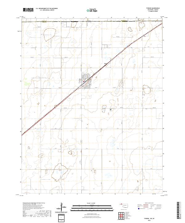
2022 Map of Tyrone
USGS Topo · Published 2022About this map
Tyrone serves as the central hub of this High Plains landscape, situated just south of the border where Oklahoma meets Kansas. The town's grid is clearly defined by local streets such as Arbell St, Florence St, and Residence St, while the community extends southward toward the Tyrone Cem. To the northeast, the smaller settlement of Fluor sits along the rail line that cuts diagonally across the township, marking the industrial and agricultural rhythm of the Texas County panhandle. The surrounding terrain is organized by a precise network of section-line roads, including Co Hwy 53 and Co Hwy D, which delineate large agricultural tracts. This layout reflects the enduring influence of the Public Land Survey System, with township and range lines like t6n r18e and t5n r19e anchoring the geography of this border region.
Find a feature on this map
41 named features on this map. Tap any name to fly to it.
Don’t see what you’re looking for? This feature index may not catch every label — zoom into the map to look around manually.
Map Details
Editions of this 2022 Tyrone Map
This is the sole edition of this map. No revisions or reprints were ever made.
Other maps of this area

1954 · Perryton
USGS Topo · 1:250,000

1955 · Dodge City
USGS Topo · 1:250,000

1958 · Perryton
USGS Topo · 1:250,000

1958 · Dodge City
USGS Topo · 1:250,000

1959 · Dodge City
USGS Topo · 1:250,000

1967 · Hooker
USGS Topo · 1:24,000

1967 · Adams
USGS Topo · 1:24,000

1967 · Hooker NW
USGS Topo · 1:24,000

1967 · Tyrone
USGS Topo · 1:24,000

1971 · Liberal
USGS Topo · 1:24,000