
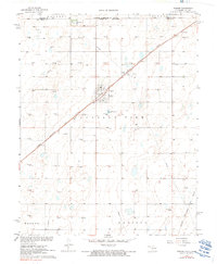
1967 Map of Tyrone
USGS Topo · Published 1968About this map
The town of Tyrone serves as the focal point of this late-1960s survey, situated along the diagonal tracks of the Chicago Rock Island and Pacific railroad. The landscape reflects a mid-century industrial economy heavily rooted in petroleum extraction, evidenced by a dense grid of extraction points including Gas Well 2919 and Gas Well 2932, alongside a prominent Refinery located near the settlement of Fluor.
Find a feature on this map
45 named features on this map. Tap any name to fly to it.
Don’t see what you’re looking for? This feature index may not catch every label — zoom into the map to look around manually.
Map Details
Editions of this 1967 Tyrone Map
2 editions found
Other maps of this area

1954 · Perryton
USGS Topo · 1:250,000

1955 · Dodge City
USGS Topo · 1:250,000

1958 · Perryton
USGS Topo · 1:250,000

1958 · Dodge City
USGS Topo · 1:250,000

1959 · Dodge City
USGS Topo · 1:250,000

1967 · Hooker
USGS Topo · 1:24,000

1967 · Adams
USGS Topo · 1:24,000

1967 · Hooker NW
USGS Topo · 1:24,000

1971 · Liberal
USGS Topo · 1:24,000

1973 · Little Ponderosa
USGS Topo · 1:24,000