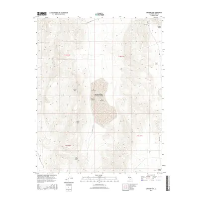
2015 Map of Ubehebe Peak
USGS Topo · Published 2015About this map
The Racetrack dominates the central basin of this high-desert landscape within Death Valley National Park, where the flat playa surface sits between the steep slopes of the Last Chance Range and the Panamint Range. This 2015 survey details the geological isolation of Racetrack Valley, accessible only by the unpaved Racetrack Valley Rd that winds past Lost Burro Gap from the north. The map highlights the striking transition from the broad, level expanse of Ulida Flat and the playa to the prominent summits of Ubehebe Peak and the unique rock outcropping known as The Grandstand. These features define a topography shaped by extreme drainage patterns, leading from the higher elevations of Hidden Valley into the deeply incised Perdido Canyon. This document provides a precise record of the remote terrain at the northern edge of the Mojave Desert, documenting the primitive road network and land boundaries that govern this protected wilderness.
Find a feature on this map
18 named features on this map. Tap any name to fly to it.
Don’t see what you’re looking for? This feature index may not catch every label — zoom into the map to look around manually.
Map Details
Editions of this 2015 Ubehebe Peak Map
This is the sole edition of this map. No revisions or reprints were ever made.
Other maps of this area

1908 · Ballarat
USGS Topo · 1:250,000

1913 · Ballarat
USGS Topo · 1:250,000

1948 · Death Valley
USGS Topo · 1:250,000

1950 · Ubehebe Peak
USGS Topo · 1:62,500

1951 · Ubehebe Peak
USGS Topo · 1:62,500

1951 · Marble Canyon
USGS Topo · 1:62,500

1954 · Death Valley
USGS Topo · 1:250,000

1956 · Death Valley
USGS Topo · 1:250,000

1957 · Death Valley
USGS Topo · 1:250,000

1957 · Tin Mountain
USGS Topo · 1:62,500