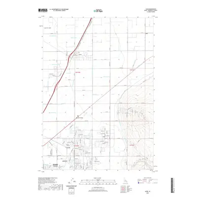
2020 Map of Ucon
USGS Topo · Published 2020About this map
Idaho Falls and its surrounding agricultural satellite communities are defined by an intricate network of irrigation infrastructure in this 2020 study of Bonneville County. The landscape is carved by numerous man-made waterways such as the Garfield Ucon Canal, Billman Canal, and the Ririe Outlet Canal, which enabled the transformation of the Snake River Valley into a productive farming region. These canals dictate the grid of the land, connecting established towns like Ucon and Iona with smaller rural hubs such as Beachs Corner and Milo.
Find a feature on this map
129 named features on this map. Tap any name to fly to it.
Don’t see what you’re looking for? This feature index may not catch every label — zoom into the map to look around manually.
Map Details
Editions of this 2020 Ucon Map
This is the sole edition of this map. No revisions or reprints were ever made.
Other maps of this area

1924 · Ammon
USGS Topo · 1:62,500

1948 · Rigby
USGS Topo · 1:24,000

1948 · Lewisville
USGS Topo · 1:24,000

1948 · Idaho Falls North
USGS Topo · 1:24,000

1948 · Idaho Falls South
USGS Topo · 1:24,000

1948 · Ucon
USGS Topo · 1:24,000

1949 · Ucon
USGS Topo · 1:24,000

1949 · Idaho Falls North
USGS Topo · 1:24,000

1949 · Rigby
USGS Topo · 1:24,000

1949 · Lewisville
USGS Topo · 1:24,000