2024 Map of Ucon
USGS Topo · Published 2024About this map
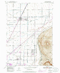
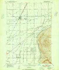
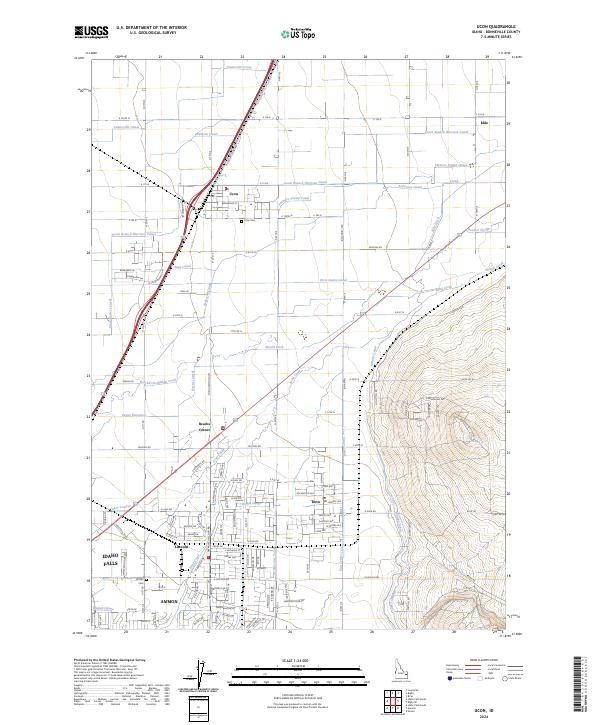
Ucon and Iona anchor an intricate grid of irrigation canals and agricultural land east of Idaho Falls. This detailed survey illustrates a sophisticated hydraulic network designed to manage water from Willow Creek and Sand Creek, featuring essential infrastructure like the South Branch Harrison Canal and the Garfield-Ucon Canal. These waterways dictate the settlement patterns of several smaller communities, including Milo, Beachs Corner, and Lincoln. Genealogists will find the exact locations of the Ucon Cem and Lincoln Cem near established neighborhoods and schools. The landscape transitions from the flat, canal-fed valley floor into the rising eastern foothills near E Foothill Rd, showing the distinct boundary between irrigated agriculture and the more varied terrain where the Hillside Canal traces the contour of the land.
Find a feature on this map
81 named features on this map. Tap any name to fly to it.
Don’t see what you’re looking for? This feature index may not catch every label — zoom into the map to look around manually.
Map Details
Editions of this 2024 Ucon Map
This is the sole edition of this map. No revisions or reprints were ever made.
Historical Maps of Ucon Through Time
3 maps found