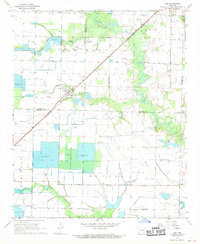
1968 Map of Ulm
USGS Topo · Published 1970About this map
Agricultural development and water management define the landscape of the Arkansas Grand Prairie during the late 1960s. The settlement of Ulm serves as a central hub, situated along the St Louis Southwestern railroad line. This period of land use is characterized by an extensive network of irrigation features including Reservoir basins and numerous wells, which supported the region's rice-farming economy. The map reveals a transition between the natural drainage systems of La Grue and Lost Bayou and the structured human alterations required for large-scale cultivation.
Find a feature on this map
23 named features on this map. Tap any name to fly to it.
Don’t see what you’re looking for? This feature index may not catch every label — zoom into the map to look around manually.
Map Details
Editions of this 1968 Ulm Map
This is the sole edition of this map. No revisions or reprints were ever made.
Other maps of this area

1935 · Clarendon
USGS Topo · 1:62,500

1937 · Stuttgart
USGS Topo · 1:62,500

1939 · Stuttgart
USGS Topo · 1:62,500

1941 · De Witt
USGS Topo · 1:62,500

1941 · Goldman
USGS Topo · 1:62,500

1941 · Clarendon
USGS Topo · 1:62,500

1948 · Helena
USGS Topo · 1:250,000

1950 · Helena
USGS Topo · 1:250,000

1954 · De Witt
USGS Topo · 1:62,500

1955 · Helena
USGS Topo · 1:250,000