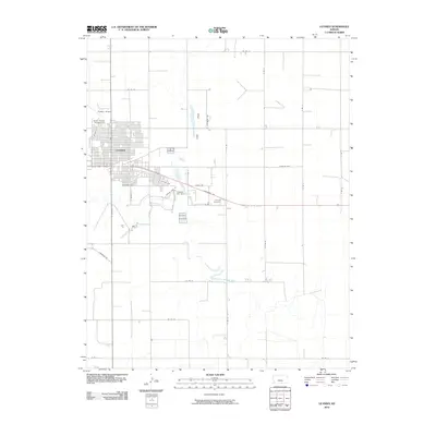
2010 Map of Ulysses
USGS Topo · Published 2010About this map
Ulysses serves as the central hub of Grant County in this 2010 survey, showing the city's structured grid and its relationship with the surrounding High Plains terrain. The landscape is defined by the ephemeral Lakin Draw and the winding North Fork Cimarron River to the south. Local landmarks like the Grant County Fairgrounds and Ulysses Airport reflect the town's role as a regional center for agriculture and commerce. Further out, the map details the rural road network, including Cimarron Rd and numerous county routes, which facilitate the movement across this expansive landscape. Water management is evident at the Ulysses City Dam, while the Ulysses Cemetery provides a point of interest for genealogists tracing local family history in this portion of western Kansas.
Find a feature on this map
34 named features on this map. Tap any name to fly to it.
Don’t see what you’re looking for? This feature index may not catch every label — zoom into the map to look around manually.
Map Details
Editions of this 2010 Ulysses Map
This is the sole edition of this map. No revisions or reprints were ever made.
Other maps of this area

1891 · Larned
USGS Topo · 1:125,000

1900 · Lakin
USGS Topo · 1:125,000

1944 · Moscow
USGS Topo · 1:62,500

1945 · Moscow
USGS Topo · 1:62,500

1955 · Dodge City
USGS Topo · 1:250,000

1958 · Dodge City
USGS Topo · 1:250,000

1959 · Dodge City
USGS Topo · 1:250,000

1959 · Ulysses NW
USGS Topo · 1:24,000

1959 · Ulysses
USGS Topo · 1:24,000

1959 · Ulysses NE
USGS Topo · 1:24,000