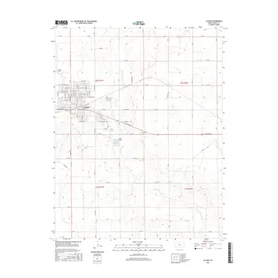
2016 Map of Ulysses
USGS Topo · Published 2016About this map
Ulysses serves as the central hub of Grant County, Kansas, exhibiting a clear grid of residential streets and industrial corridors as of 2016. The town's layout is defined by thoroughfares like W Oklahoma Ave and N Main St, reflecting its role as a regional anchor for the surrounding agricultural plains. The landscape is marked by the winding path of the N Fork Cimarron River, which cuts through the southern sections of the quadrangle alongside Lakin Draw. Local recreation and infrastructure are anchored by Ulysses City Lake and the Ulysses Airport to the northwest. For those tracing local history or family roots, the Ulysses Cem is located east of the main town center, positioned along E Oklahoma Ave as it heads toward the neighboring sections of t28s r36w.
Find a feature on this map
76 named features on this map. Tap any name to fly to it.
Don’t see what you’re looking for? This feature index may not catch every label — zoom into the map to look around manually.
Map Details
Editions of this 2016 Ulysses Map
This is the sole edition of this map. No revisions or reprints were ever made.
Other maps of this area

1891 · Larned
USGS Topo · 1:125,000

1900 · Lakin
USGS Topo · 1:125,000

1944 · Moscow
USGS Topo · 1:62,500

1945 · Moscow
USGS Topo · 1:62,500

1955 · Dodge City
USGS Topo · 1:250,000

1958 · Dodge City
USGS Topo · 1:250,000

1959 · Dodge City
USGS Topo · 1:250,000

1959 · Ulysses NW
USGS Topo · 1:24,000

1959 · Ulysses
USGS Topo · 1:24,000

1959 · Ulysses NE
USGS Topo · 1:24,000