
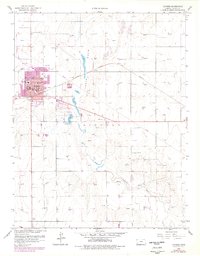
1959 Map of Ulysses
USGS Topo · Published 1960About this map
Ulysses serves as the focal point of this Grant County survey, showing the town's mid-century expansion south toward the North Fork Cimarron River. The landscape is a study in High Plains resource extraction and infrastructure, with dozens of Gas Wells dotting the surrounding Lincoln township. Transportation and recreation are centered on the western edge of town, where the Ulysses Airport and County Fairground sit near the local Sullivan Sch.
Find a feature on this map
22 named features on this map. Tap any name to fly to it.
Don’t see what you’re looking for? This feature index may not catch every label — zoom into the map to look around manually.
Map Details
Editions of this 1959 Ulysses Map
2 editions found
Other maps of this area

1891 · Larned
USGS Topo · 1:125,000

1900 · Lakin
USGS Topo · 1:125,000

1944 · Moscow
USGS Topo · 1:62,500

1945 · Moscow
USGS Topo · 1:62,500

1955 · Dodge City
USGS Topo · 1:250,000

1958 · Dodge City
USGS Topo · 1:250,000

1959 · Dodge City
USGS Topo · 1:250,000

1959 · Ulysses NW
USGS Topo · 1:24,000

1959 · Ulysses NE
USGS Topo · 1:24,000

1959 · Hickok NW
USGS Topo · 1:24,000