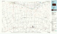
1985 Map of Ulysses
USGS Topo · Published 1985About this map
Ulysses serves as a central hub in this mid-1980s portrait of High Plains agricultural and industrial life across southwestern Kansas. The landscape is defined by the heavy presence of the Gas Field, which stretches across multiple counties including Grant and Stanton. Along the northern corridor, the Arkansas River is flanked by an extensive network of irrigation infrastructure, including the Alamo Ditch, Aubrey Ditch, and Southside Ditch, which supported the region's ranching and farming operations. The heavy transit infrastructure of the Atchison Topeka and Santa Fe railroad tracks the river's path, connecting settlements like Syracuse, Kendall, and Lakin. Further south, the landscape is more sparsely settled, characterized by the winding path of Bear Creek and the long, straight reaches of the Sullivans Track and Columbian Track, illustrating the grid-based expansion typical of this prairie era.
Find a feature on this map
49 named features on this map. Tap any name to fly to it.
Don’t see what you’re looking for? This feature index may not catch every label — zoom into the map to look around manually.
Map Details
Editions of this 1985 Ulysses Map
This is the sole edition of this map. No revisions or reprints were ever made.
Other maps of this area

1890 · Granada
USGS Topo · 1:125,000

1891 · Albany
USGS Topo · 1:125,000

1891 · Larned
USGS Topo · 1:125,000

1892 · Vilas
USGS Topo · 1:125,000

1892 · Granada
USGS Topo · 1:125,000

1893 · Albany
USGS Topo · 1:125,000

1894 · Granada
USGS Topo · 1:125,000

1896 · Garden
USGS Topo · 1:125,000

1900 · Syracuse
USGS Topo · 1:125,000

1900 · Lakin
USGS Topo · 1:125,000