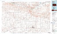
1987 Map of Ulysses
USGS Topo · Published 1988About this map
The Arkansas River and the Atchison Topeka and Santa Fe railroad corridor define the northern boundary of this Western Kansas landscape, connecting the settlements of Syracuse, Kendall, and Lakin. As an 1100,000-scale metric topographic map, it illustrates the vast infrastructure of the High Plains during the late twentieth century, most notably the extensive Gas Field operations that dominate the central and southeastern reaches. The terrain is shaped by the complex drainage systems of Bear Creek and its many tributaries, including North Bear Creek and South Fork Bear Creek, which cut through the agricultural townships. Local commerce centers on Ulysses and Johnson (Johnson City), while the presence of the Stanton County Municipal Airport and Ulysses Airport highlights the regional reliance on aviation. For genealogists and local historians, the map provides a clear view of the rural settlement pattern, from the grain stops at Hickok and Stano to the waters of Lake McKinney.
Find a feature on this map
51 named features on this map. Tap any name to fly to it.
Don’t see what you’re looking for? This feature index may not catch every label — zoom into the map to look around manually.
Map Details
Editions of this 1987 Ulysses Map
This is the sole edition of this map. No revisions or reprints were ever made.
Other maps of this area

1890 · Granada
USGS Topo · 1:125,000

1891 · Albany
USGS Topo · 1:125,000

1891 · Larned
USGS Topo · 1:125,000

1892 · Vilas
USGS Topo · 1:125,000

1892 · Granada
USGS Topo · 1:125,000

1893 · Albany
USGS Topo · 1:125,000

1894 · Granada
USGS Topo · 1:125,000

1896 · Garden
USGS Topo · 1:125,000

1900 · Syracuse
USGS Topo · 1:125,000

1900 · Lakin
USGS Topo · 1:125,000