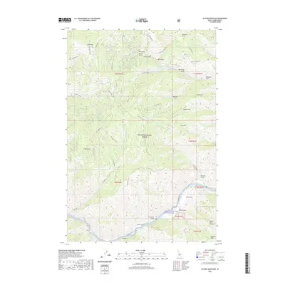
2020 Map of Ulysses Mountain
USGS Topo · Published 2020About this map
Ulysses Mtn and the high peaks of the Salmon River Mountains dominate this 2020 landscape in Lemhi County, reflecting a topography defined by steep drainage systems and established forest management. The area is managed as part of the Salmon National Forest, where a network of forest development roads, including Ulysses Lookout Rd and Buster Gulch Rd, provides access to various high-altitude points and water sources.
Find a feature on this map
63 named features on this map. Tap any name to fly to it.
Don’t see what you’re looking for? This feature index may not catch every label — zoom into the map to look around manually.
Map Details
Editions of this 2020 Ulysses Mountain Map
This is the sole edition of this map. No revisions or reprints were ever made.
Other maps of this area

1955 · Dillon
USGS Topo · 1:250,000

1956 · Elk City
USGS Topo · 1:250,000

1957 · Dillon
USGS Topo · 1:250,000

1958 · Dillon
USGS Topo · 1:250,000

1960 · Elk City
USGS Topo · 1:250,000

1960 · Ulysses Mtn
USGS Topo · 1:62,500

1960 · Piquett Mountain
USGS Topo · 1:62,500

1962 · Dillon
USGS Topo · 1:250,000

1965 · Dillon
USGS Topo · 1:250,000
1966 · Bird Creek
USGS Topo · 1:24,000