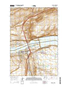
2014 Map of Umatilla
USGS Topo · Published 2014About this map
The Columbia River serves as the focal point of this 2014 survey, where the borders of Oregon and Washington meet at the Umatilla Bridge. The landscape is dominated by the managed waters of Lake Umatilla and Lake Wallula, separated by the massive infrastructure at North McNary. This area is a critical junction for regional transport and water management, evidenced by the complex network of the Brownell Ditch, W Extension Irrigation Canal, and numerous laterals including the OA Lateral and OB Lateral.
Find a feature on this map
84 named features on this map. Tap any name to fly to it.
Don’t see what you’re looking for? This feature index may not catch every label — zoom into the map to look around manually.
Map Details
Editions of this 2014 Umatilla Map
This is the sole edition of this map. No revisions or reprints were ever made.
Other maps of this area

1908 · Umatilla
USGS Topo · 1:125,000

1917 · Pasco
USGS Topo · 1:125,000

1953 · Pendleton
USGS Topo · 1:250,000

1953 · Walla Walla
USGS Topo · 1:250,000

1956 · Pendleton
USGS Topo · 1:250,000

1958 · Walla Walla
USGS Topo · 1:250,000

1962 · Hat Rock
USGS Topo · 1:24,000

1962 · Stanfield
USGS Topo · 1:24,000

1962 · Ordnance
USGS Topo · 1:24,000

1962 · Hermiston
USGS Topo · 1:24,000