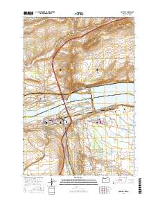
2017 Map of Umatilla
USGS Topo · Published 2017About this map
The Columbia River serves as the dominant geographical divide here, marking the boundary between Washington and Oregon. On the northern bank in Benton County, Plymouth and North McNary overlook the McNary Range Channel and Lake Wallula. To the south in Umatilla County, the city of Umatilla sits at the confluence where the Umatilla River feeds into the larger Columbia system. The landscape is defined by its complex water management infrastructure, featuring the W Extension Irrigation Canal, Brownell Ditch, and Umatilla Drain which support the surrounding agriculture. Genealogists can locate the Pioneer Memorial Cem and Sunset Hills Cem near the town center. The topographic survey also captures prominent local landmarks like Sillusi Butte and Umatilla Butte, alongside the transition from canyon terrain at Taylor Canyon to the managed pools of the river valley.
Find a feature on this map
98 named features on this map. Tap any name to fly to it.
Don’t see what you’re looking for? This feature index may not catch every label — zoom into the map to look around manually.
Map Details
Editions of this 2017 Umatilla Map
This is the sole edition of this map. No revisions or reprints were ever made.
Other maps of this area

1908 · Umatilla
USGS Topo · 1:125,000

1917 · Pasco
USGS Topo · 1:125,000

1953 · Pendleton
USGS Topo · 1:250,000

1953 · Walla Walla
USGS Topo · 1:250,000

1956 · Pendleton
USGS Topo · 1:250,000

1958 · Walla Walla
USGS Topo · 1:250,000

1962 · Hat Rock
USGS Topo · 1:24,000

1962 · Stanfield
USGS Topo · 1:24,000

1962 · Ordnance
USGS Topo · 1:24,000

1962 · Hermiston
USGS Topo · 1:24,000