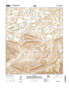
2016 Map of Umiat A-4 NW
USGS Topo · Published 2016About this map
Nakaktuk Lakes sit within a high-latitude drainage basin in the North Slope Borough, where the shifting hydrology of the Arctic coastal plain is documented. The Kutchik River winds through the landscape, showing its characteristic braided and meandering patterns across the township boundaries of t2s r2w, t3s r2w, and t4s r2w. This topography provides a clear look at the surface water features and elevation contours of the region as they were recorded in the early twenty-first century. The map serves as a primary source for identifying the exact positioning of these remote water bodies and the drainage network of the Arctic slope before further environmental changes might alter their course.
Find a feature on this map
8 named features on this map. Tap any name to fly to it.
Don’t see what you’re looking for? This feature index may not catch every label — zoom into the map to look around manually.
Map Details
Editions of this 2016 Umiat A-4 NW Map
This is the sole edition of this map. No revisions or reprints were ever made.
Other maps of this area

1952 · Umiat
USGS Topo · 1:250,000

1955 · Umiat B-4
USGS Topo · 1:63,360

1955 · Umiat A-4
USGS Topo · 1:63,360

1955 · Umiat A-5
USGS Topo · 1:63,360

1955 · Umiat B-5
USGS Topo · 1:63,360

1956 · Umiat
USGS Topo · 1:250,000

1964 · Umiat
USGS Topo · 1:250,000
2016 · Umiat A-4 NE
USGS Topo · 1:25,000
2016 · Umiat A-4 SW
USGS Topo · 1:25,000
2016 · Umiat B-5 SE
USGS Topo · 1:25,000