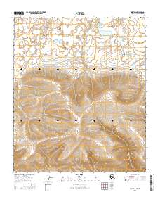
2016 Map of Umiat A-4 NE
USGS Topo · Published 2016About this map
Natvatchiak Hill dominates the central landscape of this North Slope region, where the topography shifts from the low-lying wetlands of the northern coastal plain into the rising foothills. This 2016 survey illustrates a remote wilderness defined by intricate contour lines and scattered water bodies, reflecting the seasonal drainage patterns of the Arctic tundra. In the southeast corner, Paunagaktuk Bluff provides a distinct change in elevation, marking the transition toward more varied upland terrain. The map is organized by the Public Land Survey System, showing the intersections of townships like t3s r1e and t4s r1w. This document serves as a detailed record of the natural landforms in an area largely untouched by permanent human infrastructure, essential for understanding the physical geography of the Umiat region.
Find a feature on this map
8 named features on this map. Tap any name to fly to it.
Don’t see what you’re looking for? This feature index may not catch every label — zoom into the map to look around manually.
Map Details
Editions of this 2016 Umiat A-4 NE Map
This is the sole edition of this map. No revisions or reprints were ever made.
Other maps of this area

1952 · Umiat
USGS Topo · 1:250,000

1955 · Umiat B-4
USGS Topo · 1:63,360

1955 · Umiat A-4
USGS Topo · 1:63,360

1955 · Umiat A-3
USGS Topo · 1:63,360

1955 · Umiat B-3
USGS Topo · 1:63,360

1956 · Umiat
USGS Topo · 1:250,000

1964 · Umiat
USGS Topo · 1:250,000
2016 · Umiat A-4 NW
USGS Topo · 1:25,000
2016 · Umiat A-3 NW
USGS Topo · 1:25,000
2016 · Umiat A-4 SW
USGS Topo · 1:25,000