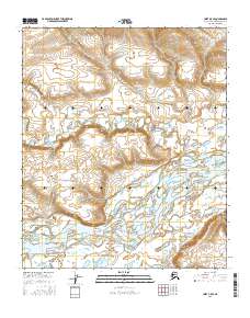
2016 Map of Umiat B-5 SE
USGS Topo · Published 2016About this map
The Colville River dominates this Arctic landscape within the North Slope Borough, its wide, braided channel carving through the tundra of northern Alaska. This 2016 survey by the U.S. Geological Survey illustrates the complex hydrological network of the region, where numerous tributaries like Prince Creek and Fossil Cr feed into the main river system. The terrain is defined by the subtle shifts of water across the North Slope, including smaller drainages such as Rainy Cr and Roger Cr. Unlike more settled regions, this map reflects a wilderness area primarily organized by its township and range lines, including t1s r3w and t2s r3w, serving as a vital reference for the physical geography of this remote territory near Umiat.
Find a feature on this map
9 named features on this map. Tap any name to fly to it.
Don’t see what you’re looking for? This feature index may not catch every label — zoom into the map to look around manually.
Map Details
Editions of this 2016 Umiat B-5 SE Map
This is the sole edition of this map. No revisions or reprints were ever made.
Other maps of this area

1952 · Umiat
USGS Topo · 1:250,000

1955 · Umiat B-4
USGS Topo · 1:63,360

1955 · Umiat A-4
USGS Topo · 1:63,360

1955 · Umiat A-5
USGS Topo · 1:63,360

1955 · Umiat B-5
USGS Topo · 1:63,360

1956 · Umiat
USGS Topo · 1:250,000

1964 · Umiat
USGS Topo · 1:250,000
2016 · Umiat B-5 SW
USGS Topo · 1:25,000
2016 · Umiat B-5 NW
USGS Topo · 1:25,000
2016 · Umiat A-4 NW
USGS Topo · 1:25,000