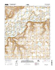
2016 Map of Umiat B-4 SW
USGS Topo · Published 2016About this map
Umiat stands as a vital outpost on the North Slope, situated where the Colville River bends through the Arctic landscape. This 2016 survey highlights the strategic and logistical importance of the Umiat Airport, which serves this remote area as a primary transportation link. The topography is defined by significant elevation changes, most notably at Tattitgak Bluff, which overlooks the river valley. Numerous watercourses, including Seabee Cr, Rainy Creek, and Fossil Creek, carve through the tundra, illustrating the complex drainage patterns that dominate the North Slope Borough. The map provides a detailed record of the township and range boundaries, including t1s r2w and t2s r1w, which delineate the public land survey system in this sparsely populated region. For researchers, the proximity of Prince Creek and other smaller tributaries offers insight into the geological and hydrological character of the Arctic coastal plain.
Find a feature on this map
13 named features on this map. Tap any name to fly to it.
Don’t see what you’re looking for? This feature index may not catch every label — zoom into the map to look around manually.
Map Details
Editions of this 2016 Umiat B-4 SW Map
This is the sole edition of this map. No revisions or reprints were ever made.
Other maps of this area

1952 · Umiat
USGS Topo · 1:250,000

1955 · Umiat B-4
USGS Topo · 1:63,360

1955 · Umiat A-4
USGS Topo · 1:63,360

1955 · Umiat A-5
USGS Topo · 1:63,360

1955 · Umiat B-5
USGS Topo · 1:63,360

1956 · Umiat
USGS Topo · 1:250,000

1964 · Umiat
USGS Topo · 1:250,000
2016 · Umiat A-4 NW
USGS Topo · 1:25,000
2016 · Umiat B-5 NE
USGS Topo · 1:25,000
2016 · Umiat A-4 NE
USGS Topo · 1:25,000