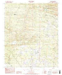
1986 Map of Umpire
USGS Topo · Published 1986About this map
Umpire and Mineola anchor this mid-1980s survey of the western Ouachita Mountains, where small settlements are interspersed among extensive public lands. The landscape is defined by the Ouachita National Forest and the Caney Creek State Wildlife Management Area, which transition into the Howard County State Wildlife Management Area to the south. This era shows a community structured around its water sources, with Moore Creek and Harris Creek feeding into the winding Saline River. Local recreation is centered at Shady Lake and the Shady Lake Recreation Area in the northern reaches of the quadrangle. Smaller named branches like Millseat Branch and Tobe Branch suggest the historic importance of timber and water-powered industry in these Arkansas highlands, while various Gravel Pits indicate local resource extraction.
Find a feature on this map
28 named features on this map. Tap any name to fly to it.
Don’t see what you’re looking for? This feature index may not catch every label — zoom into the map to look around manually.
Map Details
Editions of this 1986 Umpire Map
2 editions found
Other maps of this area

1906 · Caddo Gap
USGS Topo · 1:125,000

1913 · De Queen
USGS Topo · 1:125,000

1936 · Athens
USGS Topo · 1:48,000

1942 · Athens
USGS Topo · 1:62,500

1950 · Mcalester
USGS Topo · 1:250,000

1955 · Little Rock
USGS Topo · 1:250,000

1956 · Little Rock
USGS Topo · 1:250,000

1959 · Umpire
USGS Topo · 1:62,500

1960 · Little Rock
USGS Topo · 1:250,000

1962 · McAlester
USGS Topo · 1:250,000