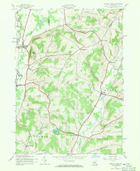
1943 Map of Unadilla Forks
USGS Topo · Published 1971About this map
Unadilla Forks and the surrounding borderlands of Otsego, Madison, and Herkimer counties are documented in this 1940s survey. The landscape is defined by the narrow valley of the Unadilla River, which serves as a natural boundary while hosting the Unadilla Valley railroad line. Settlement is concentrated in small clusters and crossroads such as Leonardsville and West Exeter, reflecting an era of decentralized rural community life.
Find a feature on this map
41 named features on this map. Tap any name to fly to it.
Don’t see what you’re looking for? This feature index may not catch every label — zoom into the map to look around manually.
Map Details
Editions of this 1943 Unadilla Forks Map
2 editions found

Other maps of this area

1907 · Winfield
USGS Topo · 1:62,500

1907 · Sangerfield
USGS Topo · 1:62,500

1910 · Hartwick
USGS Topo · 1:62,500

1910 · New Berlin
USGS Topo · 1:62,500

1912 · New Berlin
USGS Topo · 1:62,500

1912 · Hartwick
USGS Topo · 1:62,500

1943 · Schuyler Lake
USGS Topo · 1:24,000

1943 · New Berlin North
USGS Topo · 1:24,000

1943 · Millers Mills
USGS Topo · 1:24,000

1943 · Cassville
USGS Topo · 1:24,000