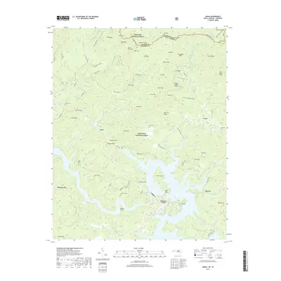
2019 Map of Unaka
USGS Topo · Published 2019About this map
Hiwassee Lake dominates the southern landscape of this region, where the fingers of the reservoir reach into deep mountain valleys. The topography is defined by the high ridges of the Nantahala National Forest and Cherokee National Forest, which meet along the state border between North Carolina and Tennessee. Evidence of long-standing mountain communities is found in the distribution of family and community burial grounds, such as Lenderman Cem near Hamby Bend and New Prospect Cem further west. Smaller settlements like Unaka and Ogreeta are situated along the complex drainage network of Beaverdam Creek and Johnson Creek. The map documents the high-elevation transition from summits like Beaverdam Bald down to the water's edge at Fowler Bend, reflecting a landscape shaped by both federal forest management and hydroelectric development.
Find a feature on this map
102 named features on this map. Tap any name to fly to it.
Don’t see what you’re looking for? This feature index may not catch every label — zoom into the map to look around manually.
Map Details
Editions of this 2019 Unaka Map
This is the sole edition of this map. No revisions or reprints were ever made.
Other maps of this area

1893 · Murphy
USGS Topo · 1:125,000

1914 · Murphy
USGS Topo · 1:125,000

1927 · Big Junction
USGS Topo · 1:24,000

1933 · Haw Knob
USGS Topo · 1:48,000

1933 · Bald River Falls
USGS Topo · 1:24,000

1934 · Murphy
USGS Topo · 1:24,000

1934 · Persimmon Creek
USGS Topo · 1:24,000

1934 · McDaniel Bald
USGS Topo · 1:24,000

1934 · Unaka
USGS Topo · 1:24,000

1934 · Murphy
USGS Topo · 1:48,000