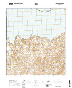
2017 Map of Unalakleet B-6 NW
USGS Topo · Published 2017About this map
St. Michael stands on the northern edge of this coastal landscape within the Nome Census Area, positioned where the land meets the expansive Norton Sound. The 2017 survey details a complex shoreline defined by significant maritime features like Saint Michael Bay and smaller inlets such as Liebes Cove and Eightmile Cove. Beyond the immediate settlement of St. Michael, the terrain is marked by coastal landmarks like Fivemile Point, while the interior consists of undeveloped tundra and small water bodies. This map provides a clear view of the geographic relationship between the historic coastal outpost and the surrounding subarctic environment, offering a precise look at the township and range divisions across this portion of the Alaska coastline.
Find a feature on this map
12 named features on this map. Tap any name to fly to it.
Don’t see what you’re looking for? This feature index may not catch every label — zoom into the map to look around manually.
Map Details
Editions of this 2017 Unalakleet B-6 NW Map
This is the sole edition of this map. No revisions or reprints were ever made.
Other maps of this area

1951 · Unalakleet
USGS Topo · 1:250,000

1951 · St Michael
USGS Topo · 1:250,000
1952 · Saint Michael C-1
USGS Topo · 1:63,360

1952 · Saint Michael B-1
USGS Topo · 1:63,360

1952 · Unalakleet B-6
USGS Topo · 1:63,360

1952 · St Michael
USGS Topo · 1:250,000

1952 · Unalakleet
USGS Topo · 1:250,000

1964 · St. Michael
USGS Topo · 1:250,000

1964 · Unalakleet
USGS Topo · 1:250,000
2017 · Saint Michael C-1 SE
USGS Topo · 1:25,000