
1952 Map of Saint Michael B-1
USGS Topo · Published 1958About this map
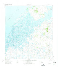
Saint Michael Island serves as a critical historical hub on the southern shore of Norton Sound in the early 1950s. The settlement of Saint Michael is well-defined, featuring a U. S. School Reserve, Radio Tower, and Russian Gardens, reflecting its long-standing role as a coastal transport and administrative node. The surrounding landscape is a complex network of wetlands and waterways, characterized by the Big Saint Michael Canal and Little Michael Canal, which divide the island from the mainland.
Find a feature on this map
23 named features on this map. Tap any name to fly to it.
Don’t see what you’re looking for? This feature index may not catch every label — zoom into the map to look around manually.
Map Details
Editions of this 1952 Saint Michael B-1 Map
2 editions found
Other maps of this area

1951 · Unalakleet
USGS Topo · 1:250,000

1951 · St Michael
USGS Topo · 1:250,000
1952 · Saint Michael B-2
USGS Topo · 1:63,360
1952 · Saint Michael C-1
USGS Topo · 1:63,360
1952 · Saint Michael C-2
USGS Topo · 1:63,360

1952 · Saint Michael A-1
USGS Topo · 1:63,360

1952 · Saint Michael A-2
USGS Topo · 1:63,360

1952 · Unalakleet B-6
USGS Topo · 1:63,360

1952 · Unalakleet A-6
USGS Topo · 1:63,360

1952 · St Michael
USGS Topo · 1:250,000