
1952 Map of Saint Michael A-2
USGS Topo · Published 1958About this map
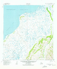
Point Romanof and the Romanof Light stand as a prominent landmark at the mouth of Pastol Bay, overlooking the waters of Norton Sound in the early 1950s. This survey, mapped by the Army Map Service using 1951 aerial photography, captures the coastal landscape of western Alaska during a period of transition. The presence of Nokrot (Aband) near the shoreline indicates a site of former activity or settlement, while further south, Coffee Point marks a distinct point along the bay. Inland, the map reveals a complex network of seasonal travel routes, including a Winter Trail that weaves through a landscape defined by the Pikmiktalik River and Charlie Creek. The detailed topography illustrates the low-lying, water-logged coastal plains common to the region, providing a specific look at the terrain before contemporary environmental shifts.
Find a feature on this map
10 named features on this map. Tap any name to fly to it.
Don’t see what you’re looking for? This feature index may not catch every label — zoom into the map to look around manually.
Map Details
Editions of this 1952 Saint Michael A-2 Map
2 editions found
Other maps of this area

1951 · St Michael
USGS Topo · 1:250,000

1952 · Kwiguk
USGS Topo · 1:250,000

1952 · Kwiguk D-1
USGS Topo · 1:63,360
1952 · Saint Michael B-2
USGS Topo · 1:63,360

1952 · Saint Michael B-1
USGS Topo · 1:63,360

1952 · Kwiguk D-2
USGS Topo · 1:63,360

1952 · Kwiguk D-3
USGS Topo · 1:63,360
1952 · Saint Michael A-3
USGS Topo · 1:63,360

1952 · Saint Michael A-1
USGS Topo · 1:63,360

1952 · St Michael
USGS Topo · 1:250,000