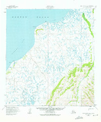
1952 Map of Saint Michael A-2
USGS Topo · Published 1976About this map
Norton Sound and Pastol Bay dominate this coastal survey of the Yukon-Kuskokwim Delta region during the early 1950s. The landscape is a dense network of thousands of small tundra ponds and meandering waterways, including the Pikmiktalik River and Kogok River. Human presence is marked by the Winter Trail which follows the coastline, providing a vital connection between points like Coffee Point and the prominent headland at Point Romanof, where the Romanof Light aided coastal navigation. A notable detail for local historians is the site of Nokrot (Aband) near the northern shore, explicitly noted as abandoned at the time of the 1952 field annotation. The map preserves the geography of this remote delta before modern changes, documenting traditional seasonal routes and the shifting nature of this water-saturated terrain.
Find a feature on this map
11 named features on this map. Tap any name to fly to it.
Don’t see what you’re looking for? This feature index may not catch every label — zoom into the map to look around manually.
Map Details
Editions of this 1952 Saint Michael A-2 Map
2 editions found
Other maps of this area

1951 · St Michael
USGS Topo · 1:250,000

1952 · Kwiguk
USGS Topo · 1:250,000

1952 · Kwiguk D-1
USGS Topo · 1:63,360
1952 · Saint Michael B-2
USGS Topo · 1:63,360

1952 · Saint Michael B-1
USGS Topo · 1:63,360

1952 · Kwiguk D-2
USGS Topo · 1:63,360

1952 · Kwiguk D-3
USGS Topo · 1:63,360
1952 · Saint Michael A-3
USGS Topo · 1:63,360

1952 · Saint Michael A-1
USGS Topo · 1:63,360

1952 · Saint Michael A-2
USGS Topo · 1:63,360